Salinity of ocean basins: which one is the saltiest?
L’articolo indaga la variazione di salinità dei bacini ocea…
The article explores how salinity varies in different ocean basins, comparing them to one another, and finding out which is the saltiest and why.
The salinity of seawater (called salinity) varies greatly across different ocean basins. Scientists refer to salinity as parts per thousand (ppm), which is the total amount of salt dissolved in the water: grams of salt dissolved in one kilogram of water.
How is salinity measured?
The instruments used to measure salinity are different, but let’s remember the main ones:
- Refractometer: an optical measuring instrument that uses different wavelengths to determine the refractive index of a substance and measure the concentration of salt in water.
- Hydrometer: an instrument for directly measuring the density of the liquid and therefore understanding its salinity.
- Satellite images: satellites such as NASA’s Aquarius take images of the same area periodically, usually on a weekly basis. These satellites are able to calculate and represent salinity using a color scale. Each color represents a certain amount of organic and inorganic substances dissolved in the water at that precise moment.

What affects salinity?
Precipitation and evaporation determine the distribution of salinity, which is also controlled by water currents. But the salinity in a specific part of the ocean also depends on the runoff from rivers.
Near the equator, the tropics consistently receive the most rainfall. As a result, freshwater falling into the ocean helps to decrease the salinity of the surface water in that region. As you move toward the poles, rainfall decreases, and with less rain and more sun, evaporation of seawater at the surface increases.
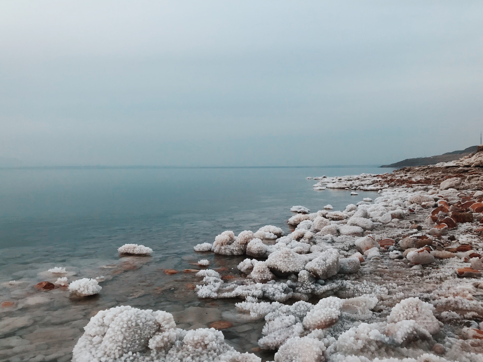
Some lakes, such as Mono Lake in California and the Caspian Sea in Asia, are even saltier. Evaporation can cause isolated bodies of water to become extremely salty, or hypersaline. A good example is the Dead Sea. The high salt content of the Dead Sea dramatically increases the density of its water, allowing humans to float much more than in the ocean. Salts are left behind when water evaporates from these landlocked water sources. Salt levels continue to increase over time. Many of these salt lakes are located in arid places, with little rainfall and warm temperatures during the day.
A Fun Fact About the Dead Sea
The Dead Sea has a salinity of 280 ppm, about eight times saltier than average seawater (35 ppm). It is so salty that no fish or aquatic plants can live there, however, some colonies of bacteria and microalgae have managed to adapt and survive in this hyper-salty ecosystem.

Pacific Ocean Basin
The salinity of surface waters in the Pacific Ocean Basin is strongly influenced by winds, precipitation, and evaporation patterns. The waters in the calm belt near the Equator generally have lower salinities than those in the trade wind belt. This is because there is a lot of rain near the Equator and little evaporation; salinity can be as low as 34 ppm.
Salinity in the open areas of the southeast, however, can be as high as 37 ppm, while the lowest salinities, less than 32 ppm, are found in the far north of the Pacific.
Atlantic Ocean Basin
The surface waters of the North Atlantic have salinity levels exceeding 37 ppm, among the highest in the world. Salinity levels in the South Atlantic are lower, at about 34.5 ppm.
This discrepancy, for example, can be explained by the strong evaporation of the Mediterranean Sea and the discharge of high-salinity water, which helps maintain the salinity of the North Atlantic.
The Sargasso Sea, which covers about 2 million square miles and is located about 2,000 miles west of the Canary Islands, is the saltiest region of the North Atlantic. The floating brown seaweed « sargassum », from which the sea is named, separates the Sargasso Sea from the open ocean.
The high water temperatures (up to 28.3°C) and the remoteness of the Sargasso Sea from the mainland cause its high salinity. This sea does not receive influxes of fresh water.
A fun fact about the Mediterranean Sea
The Mediterranean Sea, for example, is saltier than the rest of the Atlantic Ocean basin. By studying the salt of the Mediterranean Sea, scientists have discovered that 5.33 million years ago, the Mediterranean Sea dried up for a long period of time. This period is known as the Messinian Salinity Crisis (MSC).

Indian Ocean Basin
The salinity of the surface waters of the Indian Ocean Basin ranges from 32 to 37 ppm, with substantial regional variations. The subtropical zone of the Southern Hemisphere has high surface salinity, while the low-salinity zones range from Indonesia to Madagascar along 10°S. At 60°S, the salinity of the surface water is between 33 and 34 ppt.
The Arabian Sea has a high-salinity upper layer, reaching 37 ppm due to high evaporation rates.
Due to the drainage of fresh water from rivers, the salinity of the surface layer of the Bay of Bengal is significantly reduced, less than 32 ppm.
A Fun Fact about the Arabian Sea
The northern Indian Ocean basin has a dipolar sea surface salinity, unique even at the same latitude range. This is because the Arabian Sea is dominated by high and low evaporation regimes and is the main discharge region for high salinity waters: the Red Sea and the Persian Gulf.
In contrast, the Bay of Bengal is characterized by higher rainfall and freshwater outflow from the world’s largest rivers (Ganges and Brahmaputra).
However, the Arabian Sea and the Bay of Bengal exchange water around Sri Lanka, maintaining a balance of salt water.

Arctic and Southern Ocean Basins
Low salinities occur in polar seas, where salt water is diluted by melting ice and continuous precipitation. Seas with river mouths or coastal inlets that receive significant runoff from precipitation falling on land can also have low salinities.
Although the Arctic Ocean basin is generally cooler than other oceans, with salinity levels ranging from 30 to 34 ppm, salinity levels vary by region, and areas with strong river inflow can have even lower salinities.
On the other hand, the Southern Ocean basin is characterized by high sea surface salinity (SSS) north of the subtropical front, large salinity gradients across the major polar fronts, and low surface salinity in the Antarctic area south of the polar front.
Bibliography
https://oceanservice.noaa.gov/facts/whysalty.html
https://www.nhm.ac.uk/discover/quick-questions/why-is-the-sea-salty.html
https://www.whoi.edu/know-your-ocean/did-you-know/what-makes-the-ocean-salty/
https://www.usgs.gov/faqs/why-ocean-salty
https://www.britannica.com/story/why-is-the-ocean-salty
https://www.americanoceans.org/facts/why-is-the-ocean-salty/
http://ponce.sdsu.edu/usgs_why_is_the_ocean_salty/usgs_why_is_the_ocean_salty.html
http://iprc.soest.hawaii.edu/users/jensen/jensenGRL01.pdf
https://www.nature.com/articles/23231


